How to Create a Map Poster in TrueSize™
TrueSize™ is not only for comparing the true size of countries. You can also turn any city, country, island, coastline, or custom import into a polished map poster for print, wallpaper, social media, or travel art.
This guide shows how to use Poster Preview to create printable map posters with custom paper fades, vignette controls, typography, frame styles, and export sizes.

1. Load the Place You Want to Turn Into a Poster
- Search for a country, city-sized region, state, island, canal, coastline, or historic territory.
- You can also import your own GeoJSON, TopoJSON, KML, GPX, or zipped Shapefile and turn that into poster art.
- Move and zoom the map until the composition feels right.
If you are new to the map, start with the main tutorial index and the examples page.
2. Enter Poster Preview
- Open the Style tab in the ribbon.
- Click Poster Preview.
- The map switches into a framed layout designed for poster creation.
Poster Preview keeps the map interactive, so you can still pan, zoom, pitch, and rotate the basemap while you are composing the poster.
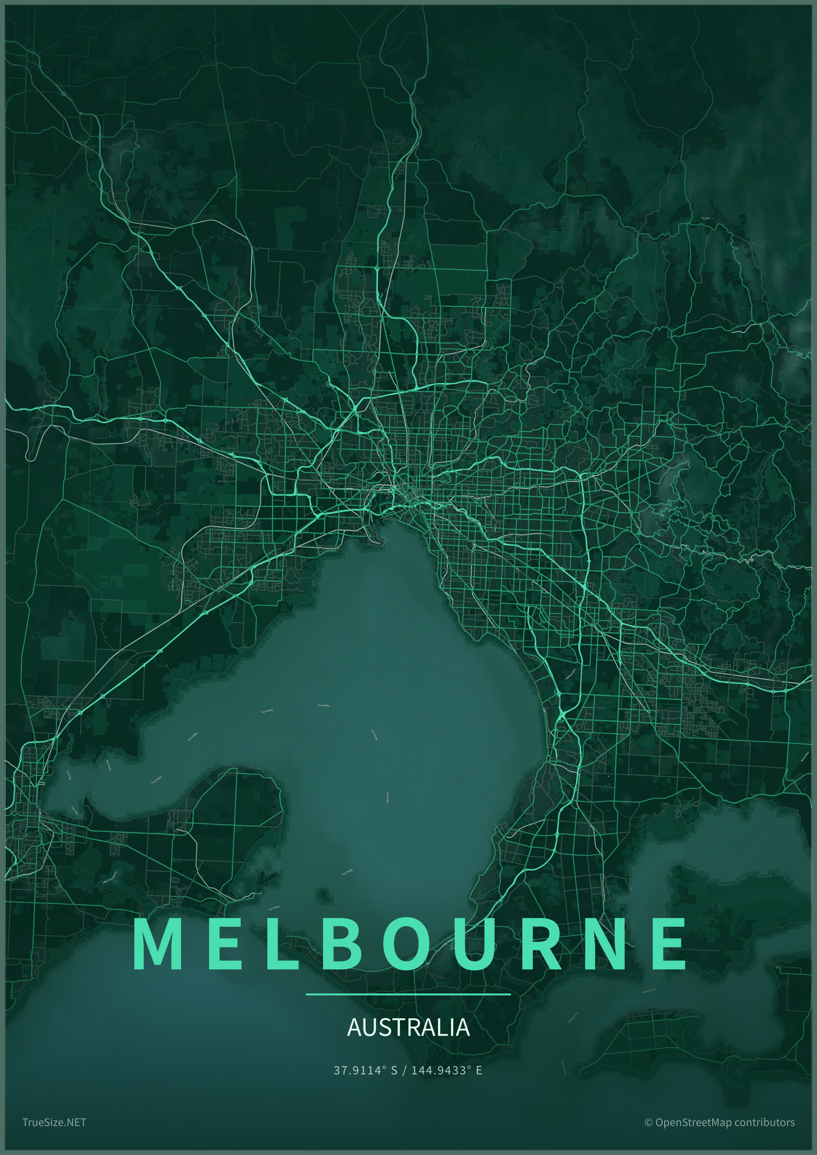
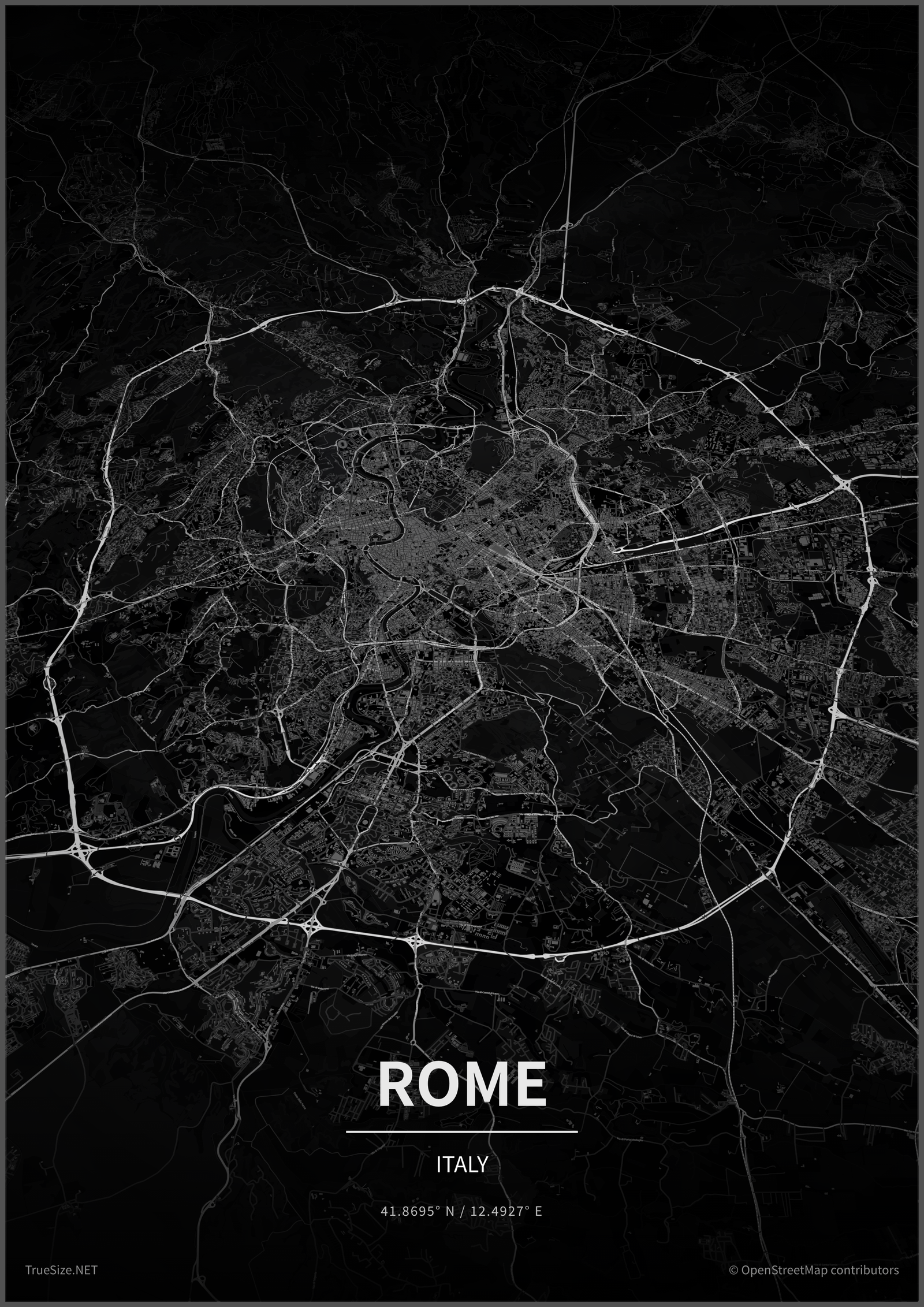
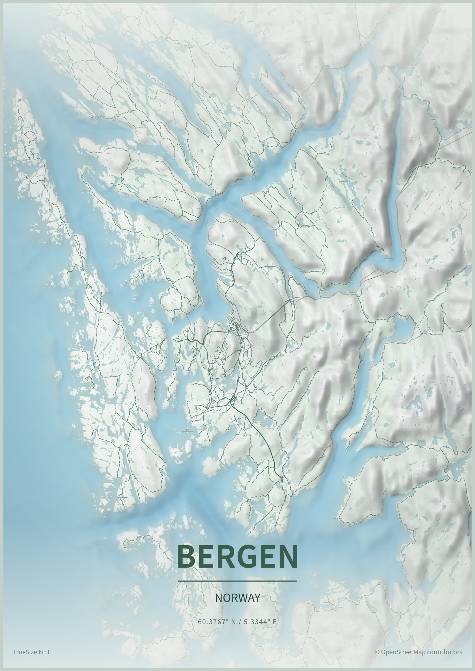
3. Set the Poster Look
Inside the Poster panel you can customize both the map and the paper treatment:
- Theme: switch the full map skin and recolor land, water, roads, borders, and poster ink.
- Overlay opacity / distance: control how strongly the paper fade covers the map and how far that fade reaches into the composition.
- Vignette opacity / distance: control how dark the outer vignette is and how deep it comes into the poster.
- Frame: switch between bleed, gallery, and mat styles, then adjust the frame thickness.
- Legend background: decide whether title and credits sit directly on the map or on a soft paper panel.
These controls are useful for both minimalist city posters and dramatic terrain-heavy wall art.
4. Tune the Poster Typography
The legend can be styled directly in the Poster panel:
- Set a custom Title and Subtitle.
- Change the font, title size, and subtitle size.
- Toggle all caps for title or subtitle without retyping the text.
- Adjust letter spacing instead of manually inserting spaces between every letter.
- Show or hide the coordinates line and recolor it independently.
This makes it easy to create both clean travel posters and more editorial-looking map prints.
5. Refine the Composition
- Use Bearing to rotate the map for a stronger diagonal layout.
- Use Pitch and optional 3D buildings for dense urban posters.
- Turn Terrain and Bathymetry on when you want mountain relief or ocean depth to show in the artwork.
- Try a different output size early so you can compose for portrait, square, banner, wallpaper, or print proportions.
Small changes in framing often make the difference between a technical map and a piece of printable map art.
6. Export the Poster
Poster Preview supports three artwork exports:
- PNG: best for raster images, quick sharing, wallpapers, and print labs that want image files.
- PDF: best for clean print handoff and page-sized poster exports.
- SVG: useful when you want a scalable vector wrapper around the exported poster image.
You can also switch output presets such as A4, A3, Instagram portrait, story format, desktop wallpaper, and phone wallpaper.
Tips for Better Printable Map Posters
- Choose one strong focal area instead of trying to show too much territory.
- Use higher vignette distance for moody posters and lower distance for cleaner modern prints.
- Use all caps with modest letter spacing for classic travel-poster typography.
- For city posters, try a darker or more contrast-heavy theme so roads and water stand out.
- For country posters, a lighter paper and softer overlay often looks better.
See More Poster Examples
The examples page now includes a full poster gallery with city and region poster samples created in TrueSize.net.
Next: Learn how to share & export data or go back to the tutorial index.