
English
English
Appearance
Greater London covers about 1,570 km², about twice the land area of New York City (about 780 km²) and about 15 times the area of the city of Paris (about 105 km²). The Tokyo Metropolis, which includes outlying islands, covers about 2,190 km². These figures depend entirely on where each city's official boundary is drawn.
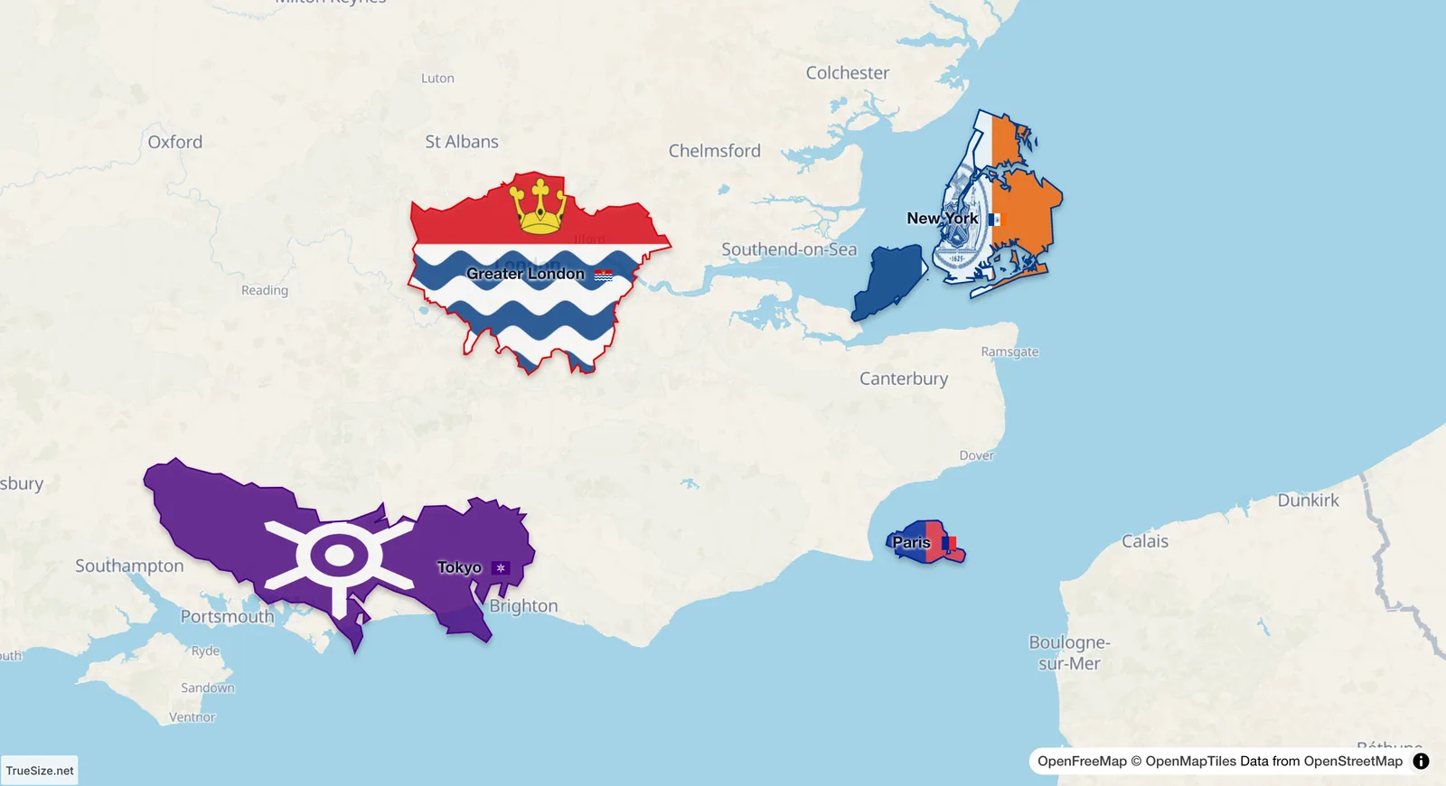
City boundaries of London, New York City, Tokyo and Paris side by side.
| City (administrative area) | Area (about) | Note |
|---|---|---|
| Tokyo Metropolis | 2,190 km² | Includes the 23 special wards (about 630 km²), western towns and distant islands |
| Greater London | 1,570 km² | The 32 London boroughs plus the City of London |
| New York City | 780 km² | Land area of the five boroughs (about 1,200 km² including water) |
| Paris (city proper) | 105 km² | Only the 20 arrondissements, without the suburbs |
Sources: national and city statistical offices, as summarized on Wikipedia. The boundaries drawn in the app come from its own region data and may differ slightly from these official numbers.
A city's size depends on how you define it. Paris looks tiny because its legal limits are tight and the suburbs belong to other municipalities. The wider Paris region (Île-de-France) covers about 12,000 km², more than 100 times the city. Tokyo and New York are measured the other way, with large administrative areas. A fair comparison needs the same kind of boundary for every city, or at least a clear note about which one is used.
Map projection matters as well. All four cities lie between about 35°N and 52°N, so a Mercator map stretches London and Paris more than Tokyo or New York. Moving them side by side at true size removes that difference.
Please rotate your device
The map needs portrait orientation on small screens — landscape leaves too little height to work with.