
English
English
Appearance
At its height around 1279, the Mongol Empire covered about 27.1 million km², measured from the map outline in TrueSize. That is about 1.6 times modern Russia and nearly 2.8 times the United States. It was widely regarded as the largest contiguous land empire in history, stretching from Korea to Eastern Europe.
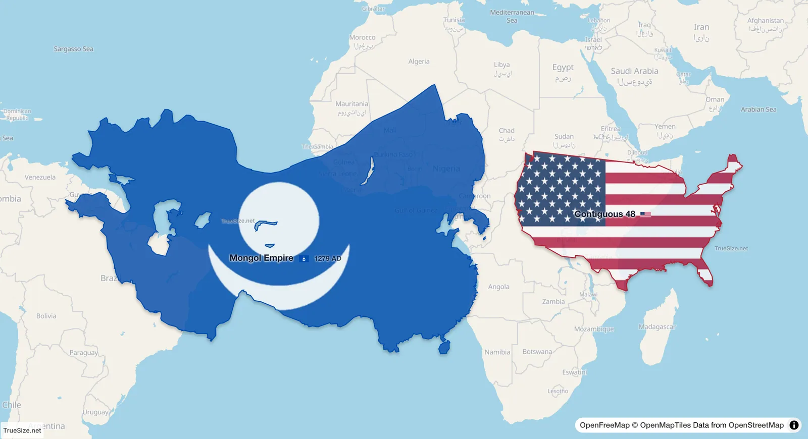
The Mongol Empire in 1279 and the 48 contiguous US states (about 8.1 million km²) side by side on the equator, each at its true size.
| Region | Area | Ratio to the Mongol Empire |
|---|---|---|
| Mongol Empire, 1279 to 1293 (peak) | 27.09 million km² (measured in TrueSize) | 1 |
| Mongol Empire, 1260s | 25.1 million km² (measured in TrueSize) | about 0.93 |
| Modern Russia | about 17.1 million km² | about 0.63 |
| Modern USA | about 9.83 million km² | about 0.36 |
| 48 contiguous US states | about 8.1 million km² | about 0.30 |
The figures depend on how the borders of the khanates are drawn, and published estimates vary. TrueSize uses one consistent outline per year, so you can compare it with other regions on the same terms.
The empire grew under Genghis Khan and his successors in the 13th century, and was divided into several khanates, including the Yuan dynasty in China and the Golden Horde in the west. The peak in the app falls in 1279, after the Mongol conquest of the Song dynasty, and the outline stays similar to 1293.
Much of the Mongol Empire lay in Central and Northern Asia. Mercator maps stretch those high latitudes, so the empire looks even larger than it was, but when you pull it down to the equator beside the 48 contiguous states, the comparison is fair. It is still about 3.4 times their area.
The timeline works on the web version and in the mobile app. The Stats button on the Tools tab shows the total area of what you have loaded.
Please rotate your device
The map needs portrait orientation on small screens — landscape leaves too little height to work with.