
English
English
Appearance
The Sahara covers about 9.2 million km². That is larger than the 48 contiguous US states (about 8.1 million km²) and close to the whole United States with Alaska and Hawaii (about 9.83 million km²) or China (about 9.6 million km²). It is the largest hot desert in the world, and it covers roughly 30% of Africa.
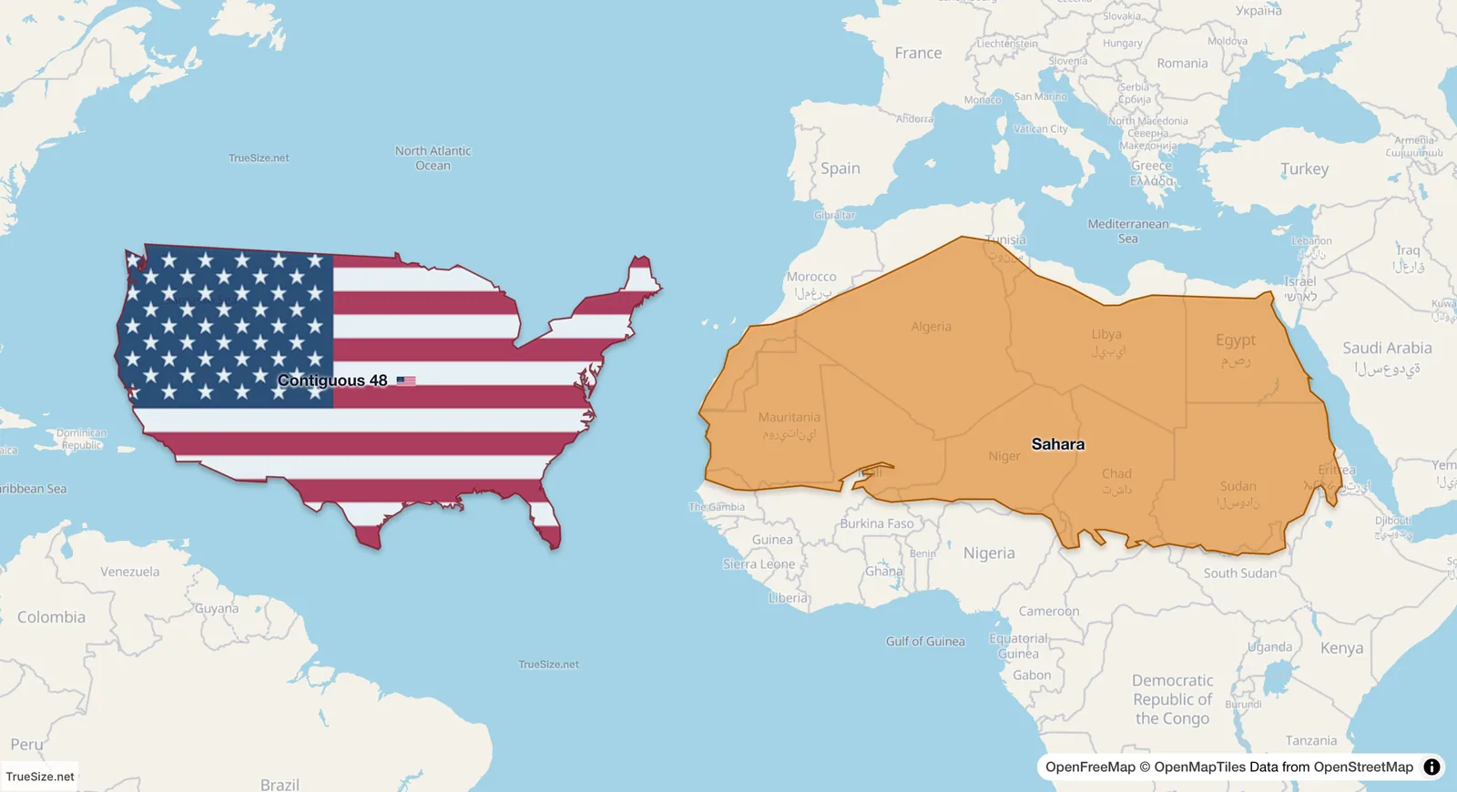
The Sahara in place and the 48 contiguous US states beside it at the same latitude: the desert is the larger of the two.
| Region | Area (about) |
|---|---|
| Sahara | 9.2 million km² |
| United States, with Alaska and Hawaii | 9.83 million km² |
| 48 contiguous US states | 8.1 million km² |
| China | 9.6 million km² |
| Europe (the continent) | 10.2 million km² |
| Africa | 30.4 million km² |
The Sahara is about 14% larger than the 48 contiguous states and only about 6% smaller than the whole USA. Published estimates of the desert vary from about 9.0 to 9.4 million km², because the southern edge (the Sahel) fades gradually and no sharp border exists. TrueSize uses its own outline of the desert, so the number you see in the app can differ slightly.
The Sahara sits between about 15°N and 35°N, so on a Mercator map it is only mildly stretched. The USA, further north, is stretched more, and Canada and Alaska more still. The result is that the Sahara can look smaller than the USA, although the two are almost equal in area. Drag the desert north in TrueSize and its true size stays constant while its shape changes.
Only part of the Sahara is sand dunes. Most of it is stony plateau, gravel plains and mountains, such as the Tibesti and Ahaggar ranges. It spans eleven countries or more, from Morocco and Mauritania in the west to Egypt and Sudan in the east.
Please rotate your device
The map needs portrait orientation on small screens — landscape leaves too little height to work with.