
English
English
Appearance
The Sakha Republic (Yakutia) in Russia is the largest first-level administrative region in the world (Greenland, an autonomous territory of Denmark, is included for comparison), at about 3.08 million km². That is almost as large as India (about 3.3 million km²) and bigger than Argentina. Western Australia, Krasnoyarsk Krai, Greenland and Nunavut follow, each about 2.1 to 2.5 million km², larger than most countries.
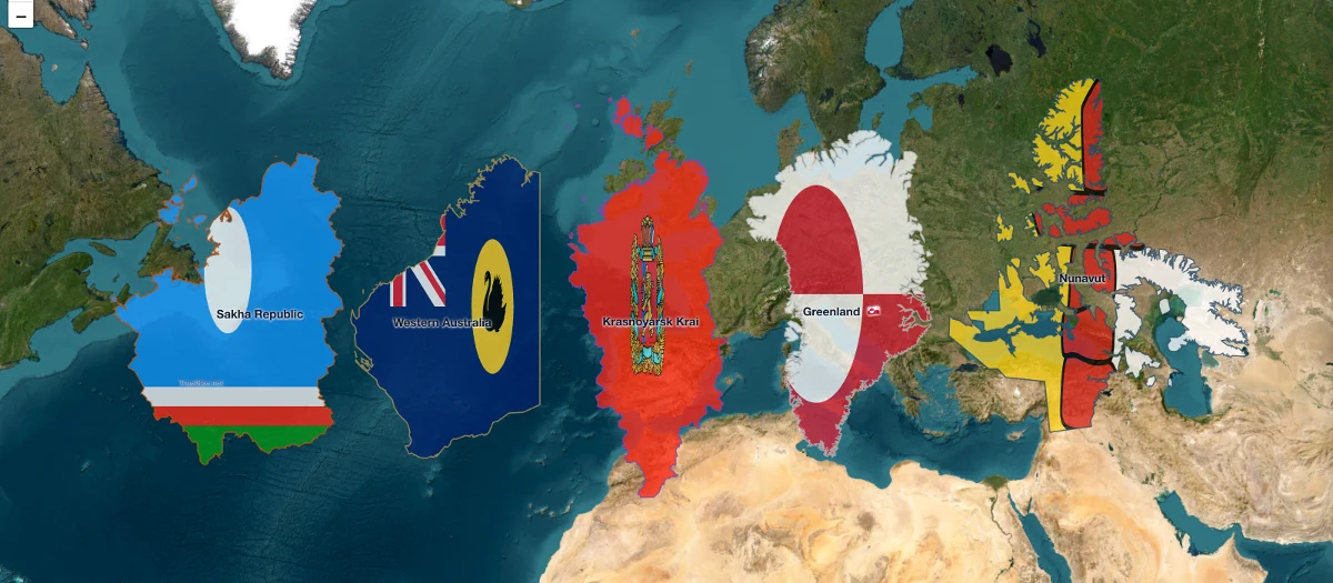
The five largest subnational regions side by side at their true size.
| Rank | Region | Country | Area (about) | Population (about) |
|---|---|---|---|---|
| 1 | Sakha Republic (Yakutia) | Russia | 3.08 million km² | 1 million |
| 2 | Western Australia | Australia | 2.53 million km² | 2.8 million |
| 3 | Krasnoyarsk Krai | Russia | 2.37 million km² | 2.8 million |
| 4 | Greenland | Denmark (autonomous territory) | 2.17 million km² | 56,000 |
| 5 | Nunavut | Canada | 2.09 million km² | 40,000 |
Sources: Wikipedia and the national statistics offices. Published area figures differ a little between sources, for example depending on whether inland water is counted, and Greenland counts here as an autonomous territory rather than a state. Antarctic territorial claims are not included.
Four of the five regions lie in the far north, where a Mercator map stretches shapes the most. Sakha and Nunavut look even larger than they are, and Western Australia, near the tropics, looks smaller than it is. Moving them side by side in TrueSize removes that effect, so the ranking becomes visible: they are all of similar size, and any of them could fit several European countries inside.
Please rotate your device
The map needs portrait orientation on small screens — landscape leaves too little height to work with.