
English
English
Appearance
The five Great Lakes cover about 244,000 km² of water, roughly the area of the United Kingdom (about 244,000 km²). The Caspian Sea is bigger still, at about 371,000 km², which is more than Germany (about 358,000 km²). Both are easiest to judge when moved onto a country at true size.
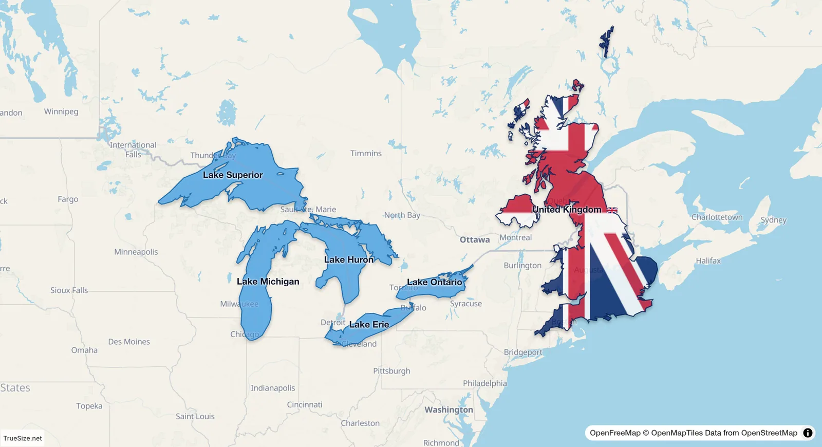
The five Great Lakes next to the United Kingdom.
| Water body | Area (about) | Similar to |
|---|---|---|
| Great Lakes, all five | 244,000 km² | United Kingdom (244,000 km²) |
| Lake Superior | 82,000 km² | Austria (84,000 km²) |
| Caspian Sea | 371,000 km² | Germany (358,000 km²) |
Lake Superior alone is the largest freshwater lake in the world by surface area. The Caspian is the largest enclosed inland body of water on Earth, and it is salty. Whether it is a lake or a sea depends on the definition, and it borders five countries: Russia, Kazakhstan, Turkmenistan, Iran and Azerbaijan. The figures are approximate and vary with water levels and sources. The Great Lakes figure is the water surface of all five lakes (Superior, Michigan, Huron, Erie, Ontario).
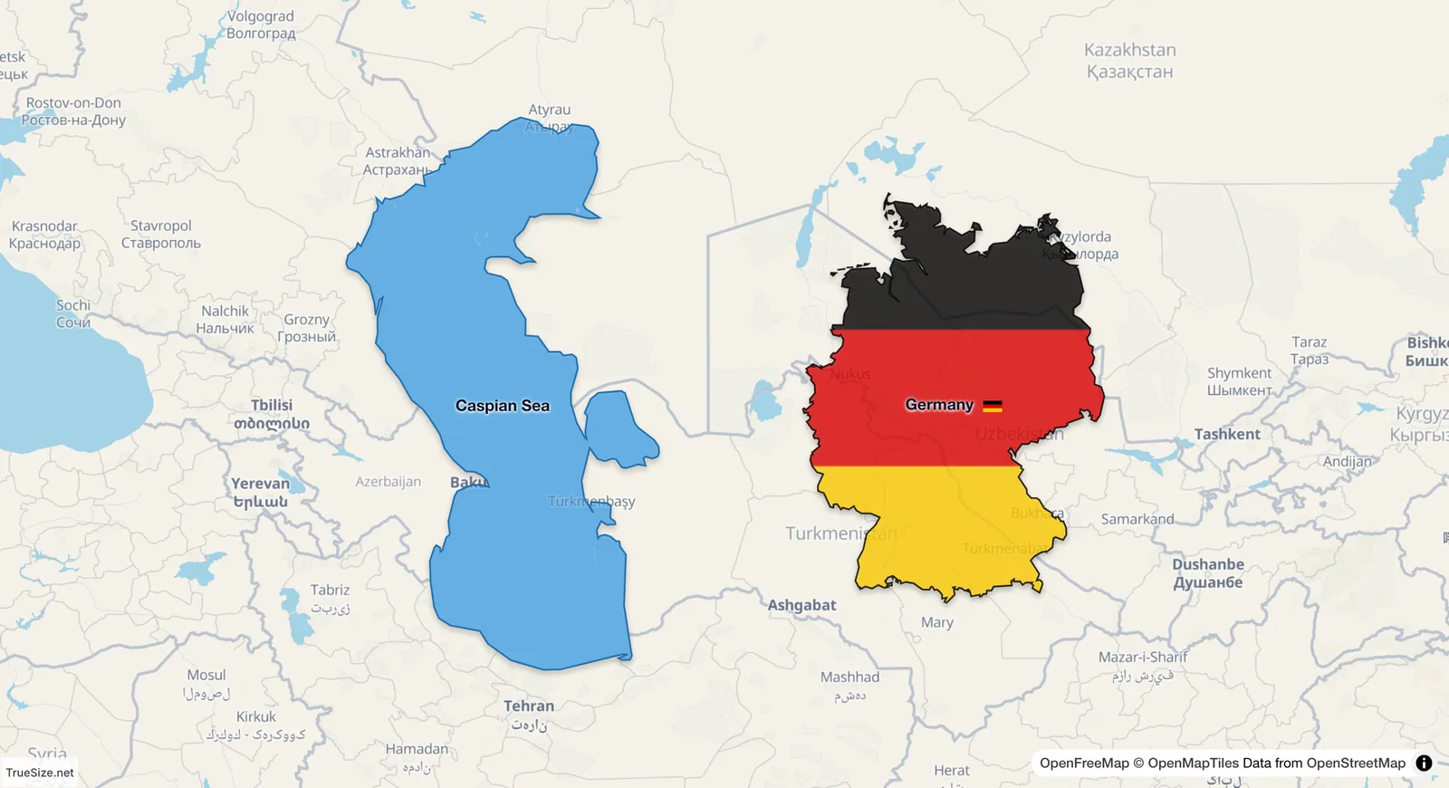
The Caspian Sea in place, with Germany moved beside it at the same latitude.
Big lakes are drawn with the same stretch as land. The Great Lakes lie between about 41°N and 49°N and are stretched by a factor of about 1.3 to 1.5 in length and width, so they look roughly twice as big in area as they are. The Caspian lies between 36°N and 47°N, stretched somewhat less. A lake that dominates a regional map therefore shrinks when you move it to another place at true size.
Please rotate your device
The map needs portrait orientation on small screens — landscape leaves too little height to work with.