
English
English
Appearance
No. Africa is about 14 times larger than Greenland. Africa covers about 30.4 million km² and Greenland about 2.17 million km². On a standard Mercator world map Greenland looks about as big as Africa, but that is a distortion that grows toward the poles.
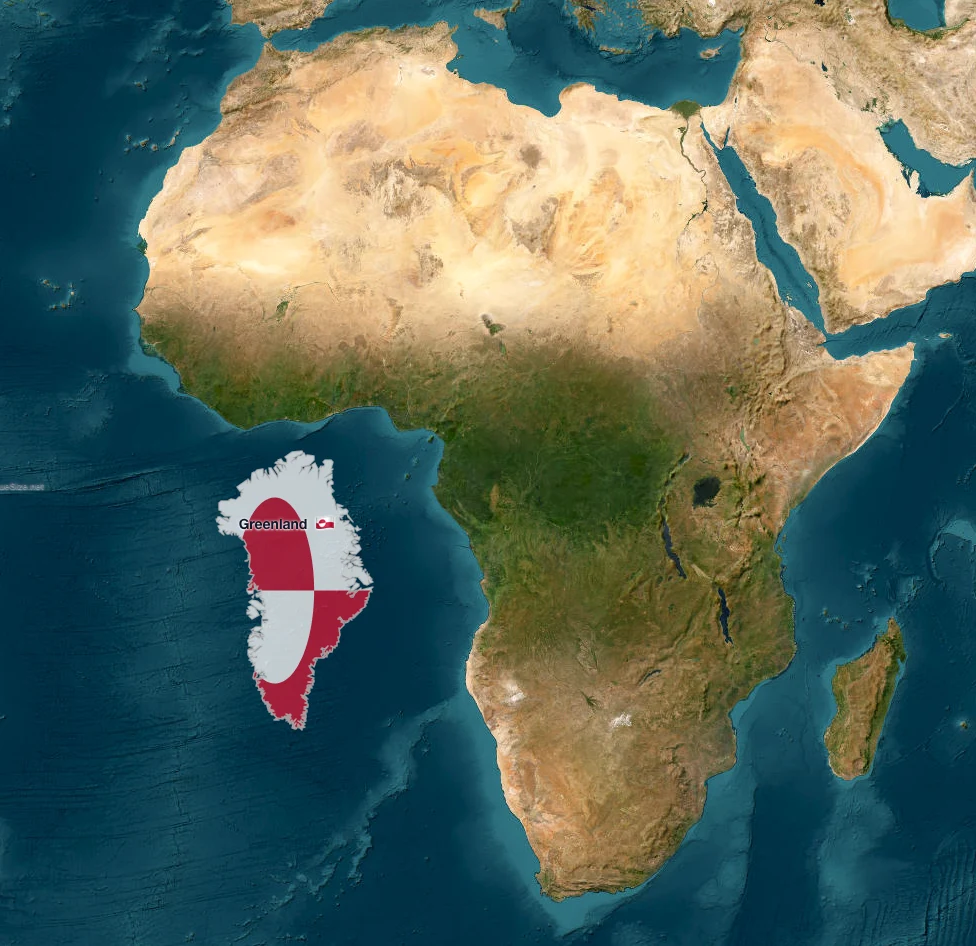
Greenland moved next to Africa on the satellite map: at true size it is a small fraction of the continent.
| Region | Area | Compared with Greenland |
|---|---|---|
| Greenland | about 2.17 million km² | 1× |
| Africa | about 30.4 million km² | about 14× |
| Mexico | about 1.96 million km² | slightly smaller |
| Saudi Arabia | about 2.15 million km² | almost the same |
Greenland is the largest island in the world, yet it is roughly the size of Saudi Arabia. Africa's area equals about 14 Greenlands. Areas are official or well-known published figures; TrueSize keeps each region's true area while you move it.
The Mercator projection was designed for navigation, not for comparing areas. It keeps angles correct by stretching the map more and more as you go away from the equator. At the latitude of Greenland, which spans about 60°N to 83°N, the stretch is large: areas look 4 to 80 times bigger than they really are. Africa sits across the equator, where the stretch is close to zero.
So the two shapes end up looking alike, even though one is about 14 times larger. The distortion is not random. It follows latitude, which is why moving a country north or south on a Mercator map seems to make it grow or shrink.
When you drag a region in TrueSize, the shape is recalculated on the sphere so its real area stays the same at every latitude. Greenland looks smaller as you drag it south, and that is correct: you are seeing its real footprint. If you want to see the distortion yourself, turn true size off with Fun → Size, and Greenland swells again as it approaches the pole.
Please rotate your device
The map needs portrait orientation on small screens — landscape leaves too little height to work with.