
English
English
Appearance
The Amazon rainforest is the largest tropical rainforest in the world. The Amazon basin covers about 7 million km², and about 6 million km² of it is forest, spread over nine countries, with about 60% in Brazil. That is roughly three quarters of the 48 contiguous US states, and more than the whole European Union.
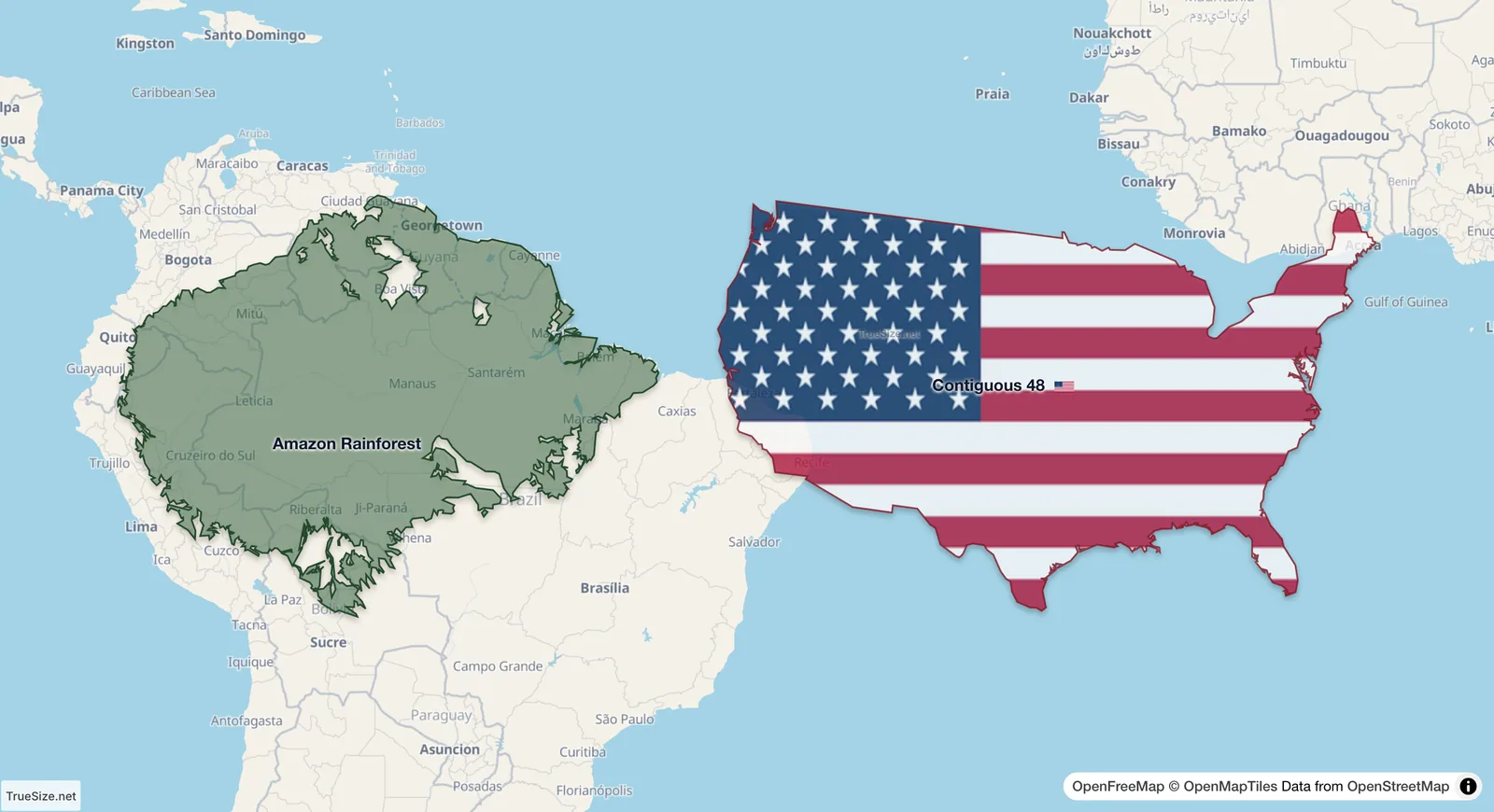
The Amazon rainforest in place and the 48 contiguous US states beside it at the same latitude.
| Region | Area (about) |
|---|---|
| Amazon basin | 7 million km² |
| Amazon rainforest | 5.5 to 6 million km² |
| 48 contiguous US states | 8.1 million km² |
| European Union | 4.2 million km² |
| Congo rainforest | 1.8 to 2.7 million km² |
| Taiga (all boreal forest) | about 15 million km² |
Published sizes of the Amazon rainforest differ because the forest has no sharp edge: it fades into savanna, and each study draws the line in its own way. TrueSize joins the moist forest ecoregions of the Amazon basin and the Guianas (RESOLVE Ecoregions 2017), which gives about 5.8 million km². The outline shows the natural extent of the forest, not the area still standing today after clearing.
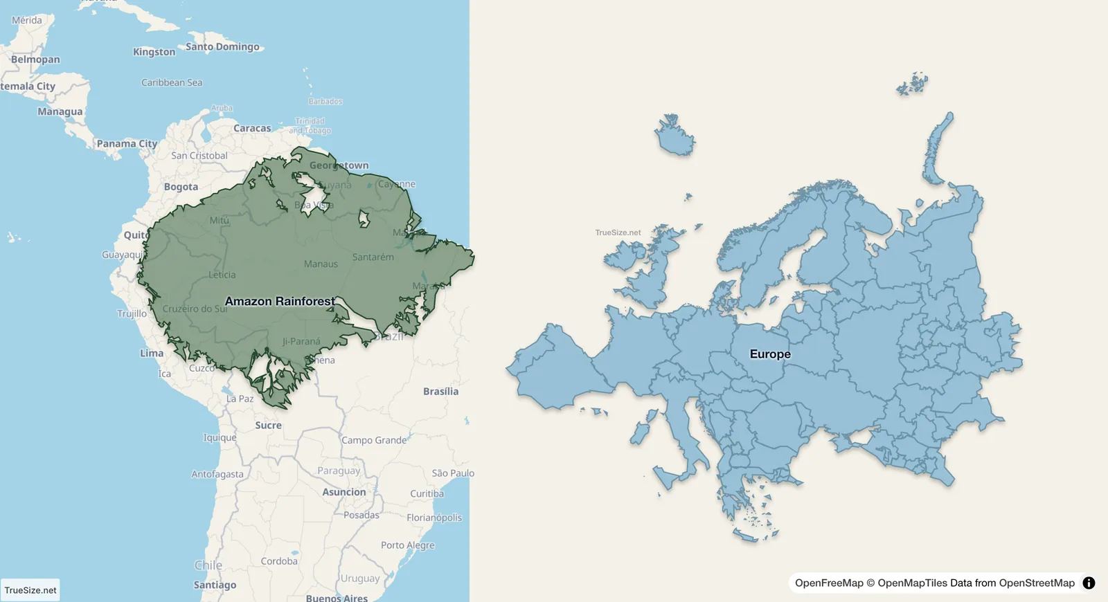
Europe beside the Amazon rainforest: the forest covers more than half of the area of the whole continent.
The Amazon lies on the equator, where the Mercator projection used by most world maps does not stretch anything. Countries far from the equator, such as Canada, Russia or the Nordic countries, are drawn much larger than they are. Next to them the Amazon looks modest, although it covers more than half of the area of the whole European continent (about 10.2 million km²).
TrueSize also has the Congo rainforest, the Atlantic Forest of Brazil, the rainforests of Borneo, Sumatra and New Guinea, the Daintree in Australia, the Valdivian and Tasmanian temperate rainforests, the Hyrcanian forests by the Caspian Sea, the Sundarbans mangroves, the Black Forest and the taiga, the boreal forest that circles the far north. Load them all at once to compare them.
Please rotate your device
The map needs portrait orientation on small screens — landscape leaves too little height to work with.