Skip to content
Ads keep this site free 🙏

Guess the Year: When Did This Country Look Like This? ​

The map shows one of today's countries as it looked in a hidden year: that land's shape in dark slate, with today's borders of the country dashed on top. Which year is it from? Pick a year, press Check and see how close you came. It is a history map game and a historical borders quiz in one: borders grow, shrink and move, and the shape is your only clue.
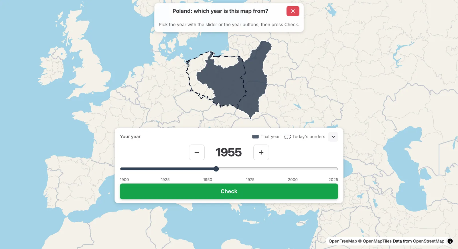
Poland's borders of a hidden year as a dark shape with today's borders of Poland dashed on top, and a card with the year 1955 on a slider from 1900 to 2025 and the Check button

The dark shape is the country in a hidden year, the dashed line its border today.

How to play ​

  1. Open the Fun tab and click or tap Guess the Year, or start at truesize.net/#guesstheyear. Read the rules and click Start.
  2. Read the prompt, for example "Poland: which year is this map from?". It names today's country. The historical name and flag stay hidden.
  3. Look at the shape against the dashed borders of today. Pinch and pan the map freely.
  4. Pick a year with the slider, or with the − and + year buttons (press and hold to keep going).
  5. Press Check. It works once you have used the slider or a button. You get one pick per map, and there is no typing.
  6. Click Next Round for the next map.

1955 picked with the slider and the − button; Check plays the borders back to 1922–1944

Points ​

You get 100 for any year in which the country had exactly these borders. That means every year the timeline draws this same outline for that country, even when the shape comes back later. Outside those years, the points halve for every 10 years you are off. For maps that begin before 1800, they halve for every 25 years. Every map can score 100.

After you check ​

You stay on the same map.

  • The shape turns green and shows its historical name and flag.
  • A short time-lapse plays the country's shapes from your year to the right years. Click Replay to watch it again. When your year was right, the button says Play to today and plays from the answer to today.
  • The result slider shows the right years as a green band, your year as an orange dot and other players' years as bars.
  • The most common wrong year shows as a faint grey dashed outline, with a chip such as "21% chose 1938".
  • A line tells you how many others played the same map and what share of them you beat.

About this map ​

After every Check, the timeline's own notes about the country appear, in your language:

  • How these borders began: the note for the year this outline starts. For Poland, that is 1922, when Upper Silesia joined.
  • Your year: what the country was in the year you picked. For Poland in 1955, that is the Polish People's Republic.

On a computer, this is a panel at the left of the map. On a phone, it is inside the result card. On small screens, a line About › opens it inside the card.
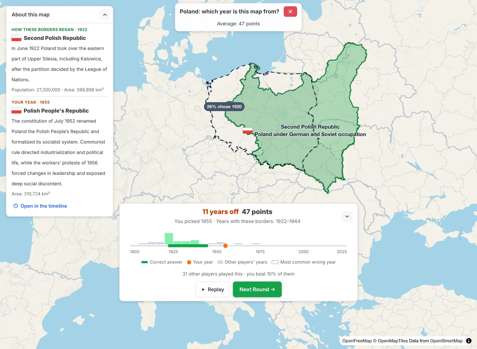
After Check: Poland's borders of 1922 to 1944 in green named Second Polish Republic, the most common wrong year as a grey dashed outline with its share of players, the About this map panel at the left, and the result card with the right years, the picked year 1955 and other players' years on the slider

Open in the timeline ​

When you have handed in the day's three maps, or in free play, Open in the timeline leaves the game and opens the historical timeline at that year with that country. Use it to look at what happened around the year you guessed.

Daily and free play ​

Guess the Year is one of the daily games: three maps a day, the same for everyone, from easy to hard. The first is a country since 1900, the second one from the 1800s and the third one from 1500 to 1799. Your points for the day are the average of the three.

In free play, open the Fun tab and pick a level: Since 1900, Since 1800 or Since 1500. The slider runs from that year to 2025. The best-known countries come first, and more countries join as you play.

Only outlines that are most likely to be right are used. Each one needs a recorded and checked outline source, and the daily maps also need dated start and end years.

Tips ​

  • Look at the coast and the corners: a shape that is smaller than today's dashed borders means land was not yet part of the country, and a bigger one means it was lost later.
  • Think of the big events: unions, wars, independence and breakups. Each one moves a border.
  • Earlier maps score in wider steps, so a guess within a few decades still earns good points.
  • Press Hide to shrink the card to one line and see the whole map. Show brings it back.

Please rotate your device

The map needs portrait orientation on small screens — landscape leaves too little height to work with.