Skip to content
Ads keep this site free 🙏

Mystery Shape: Name a Place from Its Outline ​

A grey outline floats on open sea, with no map around it. Which country is it? Mystery Shape shows the place at its true size, so it looks the way it really is and not the way a Mercator map stretches it. Every wrong guess stands right beside it at the same scale, with clues that lead you to the answer.
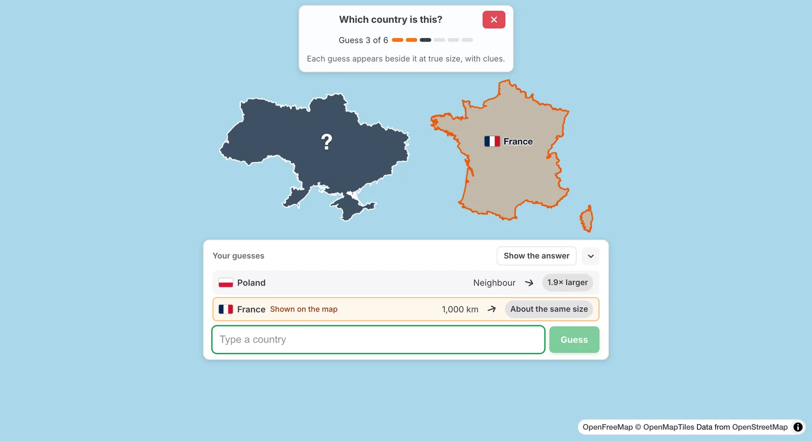
A dark country outline with a question mark on open sea, France drawn beside it at the same scale, and a card listing the guesses Poland and France with their distance, direction and size clues

Your latest guess stands beside the mystery shape at the same scale; the card keeps every guess with its clues.

How to play ​

  1. Open the Fun tab and click or tap Mystery Shape, or start at truesize.net/#mysteryshape. Pick Countries or States and provinces, then click Start.
  2. Type a name and pick it from the list. You can type in your own language or in English, and common short names such as USA or UK work too.
  3. A wrong guess appears beside the mystery shape at the same scale, so you can compare the two outlines. It also gets three clues:
    • How far: the distance between the nearest edges of the two places, or Neighbour when they share a border.
    • Which way: an arrow that points from your guess towards the mystery place.
    • How large: how many times larger or smaller the mystery place is than your guess.
  4. You have six guesses. If you are stuck, Show the answer ends the round.
  5. At the end, the shape gets its flag and flies home on the normal map. On the way it grows or shrinks, as every place does on TrueSize. The card says how much larger the map shows it at home than its true size.
  6. The most common wrong first guesses of other players appear on the map as faint dashed outlines, each with its share of the players.

Poland and France stand beside the shape with their clues; the third guess, Ukraine, flies home

Points ​

Naming the place on the first guess is worth 100 points, then 80, 60, 40, 20 and 10. If you run out of guesses or show the answer, the round is worth 0. There is no clock, so take your time.

States and provinces ​

In free play you can also pick States and provinces. The question names the country ("…: which region is this?"), and the list suggests that country's regions only. It starts with the best-known countries and widens as you go.

True size, not a stretched map ​

The mystery shape sits on the equator, where a Mercator map shows true sizes. That is why large northern countries look smaller and less stretched than you may remember. Watch the answer fly home: places far from the equator grow on the way, and the card tells you by how much.
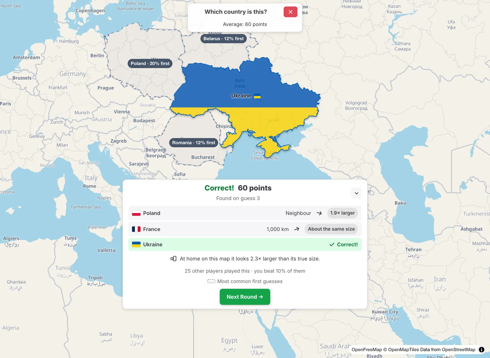
Ukraine at home on the map in its flag colours after the round, the dashed outlines of Poland, Belarus and Romania with the share of players who guessed them first, and the result card saying the map shows Ukraine 2.3 times larger than its true size

Small screens ​

On a phone, the arrow button next to Show the answer hides the card down to one line with your latest clue, so you can see the whole shape. Tap the line to bring the card back. You can pinch and zoom the map at any time.

Daily and free play ​

Mystery Shape is one of the daily games: three shapes a day, the same for everyone. The first two are countries, the third is a state or province of a well-known country. Your points for the day are the average of the three shapes. In free play from the Fun tab you get a new shape every round.

Tips ​

  • Look at the coastline first: a long coast, a peninsula or a group of islands narrows it down quickly.
  • Use the size clue early. A guess that is ten times larger tells you a lot.
  • The arrow points along the shortest path over the globe, which can look curved on a flat map.

Please rotate your device

The map needs portrait orientation on small screens — landscape leaves too little height to work with.